


Voting District 10705, Los Angeles County, California
About
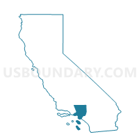
Outline

Summary
| Unique Area Identifier | 534167 |
| Name | Voting District 10705 |
| County | Los Angeles County |
| State | California |
| Area (square miles) | 2.11 |
| Land Area (square miles) | 1.82 |
| Water Area (square miles) | 0.29 |
| % of Land Area | 86.28 |
| % of Water Area | 13.72 |
| Latitude of the Internal Point | 34.03446650 |
| Longtitude of the Internal Point | -118.06011700 |
Maps


Graphs
Select a template below for downloading or customizing gragh for Voting District 10705, Los Angeles County, California


Neighbors
Neighoring Voting District (by Name) Neighboring Voting District on the Map
- Voting District 10291, Los Angeles County, CA
- Voting District 10297, Los Angeles County, CA
- Voting District 10657, Los Angeles County, CA
- Voting District 10708, Los Angeles County, CA
- Voting District 10711, Los Angeles County, CA
- Voting District 10729, Los Angeles County, CA
- Voting District 10741, Los Angeles County, CA
- Voting District 10744, Los Angeles County, CA
- Voting District 10747, Los Angeles County, CA
- Voting District 10759, Los Angeles County, CA
- Voting District 10786, Los Angeles County, CA
- Voting District 10789, Los Angeles County, CA
- Voting District 10792, Los Angeles County, CA
- Voting District 10795, Los Angeles County, CA
- Voting District 10801, Los Angeles County, CA
- Voting District 10804, Los Angeles County, CA
Top 10 Neighboring County Subdivision (by Population) Neighboring County Subdivision on the Map
- East San Gabriel Valley CCD, Los Angeles County, CA (935,875)
- Upper San Gabriel Valley CCD, Los Angeles County, CA (323,899)
- Southwest San Gabriel Valley CCD, Los Angeles County, CA (318,982)
- Whittier CCD, Los Angeles County, CA (316,911)
Top 10 Neighboring Place (by Population) Neighboring Place on the Map
- Whittier city, CA (85,331)
- Pico Rivera city, CA (62,942)
- Montebello city, CA (62,500)
- South El Monte city, CA (20,116)
- Avocado Heights CDP, CA (15,411)
Top 10 Neighboring Elementary School District (by Population) Neighboring Elementary School District on the Map
- Whittier City Elementary School District, CA (67,511)
- Garvey Elementary School District, CA (53,116)
- Valle Lindo Elementary School District, CA (6,036)
Top 10 Neighboring Secondary School District (by Population) Neighboring Secondary School District on the Map
- Whittier Union High School District, CA (218,195)
- El Monte Union High School District, CA (172,581)
- Alhambra Unified (9-12) School District, CA (53,116)
Top 10 Neighboring Unified School District (by Population) Neighboring Unified School District on the Map
Top 10 Neighboring State Legislative District Lower Chamber (by Population) Neighboring State Legislative District Lower Chamber on the Map
- Assembly District 58, CA (429,216)
- Assembly District 57, CA (428,193)
- Assembly District 49, CA (418,796)
Top 10 Neighboring State Legislative District Upper Chamber (by Population) Neighboring State Legislative District Upper Chamber on the Map
Top 10 Neighboring 111th Congressional District (by Population) Neighboring 111th Congressional District on the Map
Top 10 Neighboring Census Tract (by Population) Neighboring Census Tract on the Map
- Census Tract 4824.02, Los Angeles County, CA (6,971)
- Census Tract 4083.02, Los Angeles County, CA (4,036)
- Census Tract 5004.03, Los Angeles County, CA (4,023)
- Census Tract 5300.04, Los Angeles County, CA (3,695)
- Census Tract 4337, Los Angeles County, CA (3,294)
- Census Tract 5003, Los Angeles County, CA (2,903)
- Census Tract 4340.04, Los Angeles County, CA (2,796)
- Census Tract 4338.02, Los Angeles County, CA (2,780)